


Bolivie jour 1

topinus
User
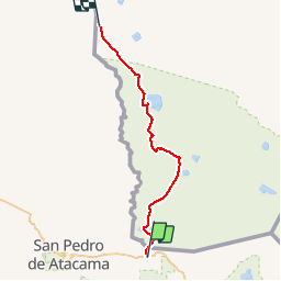

Length
169 km

Max alt
4916 m

Uphill gradient
2004 m
Km-Effort
196 km

Min alt
4292 m

Downhill gradient
2086 m
Boucle
No
Creation date :
2019-11-07 12:28:25.22
Updated on :
2019-11-10 09:23:55.055
8h42
Difficulty : Very easy

FREE GPS app for hiking
 SityTrail
IGN / Geographical institutes
SityTrail World
The world is yours!
About
Trail Car of 169 km to be discovered at Antofagasta Region, Provincia de El Loa, San Pedro de Atacama. This trail is proposed by topinus.
Positioning
Country:
Chile
Region :
Antofagasta Region
Department/Province :
Provincia de El Loa
Municipality :
San Pedro de Atacama
Location:
Unknown
Start:(Dec)
Start:(UTM)
622588 ; 7464693 (19K) S.
Comments
Trails nearby